Usually when we have a full cycling day adventure it’s a good idea to look up the routes in advance as we want our cycling to be enjoyable, without much cars (or ideally without any cars), and on a terrain that suits our preferences and time schedule. Of course, the more developed your country’s cycling infrastructure is, the less research you need to do and vice versa.
The factors I normally take into account are distance, elevation profile, road priority (busyness) and road condition. Elevation profile and road condition tell me how long a distance I can cover. Busy roads are normally avoided but if I am under time pressure they can be useful once in a while.
In this article I will share my experience planning routes with a few different apps – Maps.me, Mapy.cz, Strava and Komoot. Distance is a basic feature in all apps, elevation profile is present in most of them but it’s accuracy varies. Road priority can be derived studying most apps and it usually tells me how busy the road can be and in what condition. There is a fine balance between the last two – the busier the road, the better condition tends to be.
In the beginning of my journey from Amsterdam to Armenia I used maps.me and it did a great job. However, as I moved to Central Europe a local cyclist recommended me Mapy.cz, a Czech app, that seemed to plan the route around more cyclist-friendly roads. And recently I have discovered Komoot which at the moment I like the most. Strava I used only in order to record all routes on the same app and perhaps later connect it to Relive.com.
Maps.me
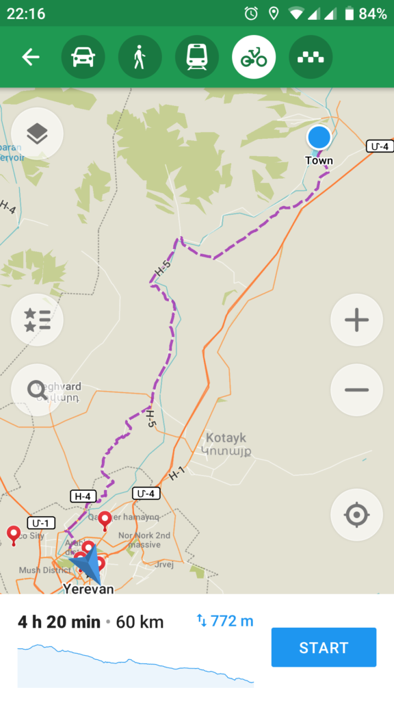
Maps.me works very well when you need a basic distance and elevation profile picture. It does quite well distinguishing between road types choosing the smaller ones when you are in the cycling mode (button on the top). The elevation profile is basic and it shows the ‘delta’ i.e. how much you will gain/loose in terms of the highest to the lowest point that day.
In addition maps.me maps can be downloaded offline and have plenty of information about points of interest – sightseeing, food, accommodation.
For me it’s an easy plan-and-go app for a relatively known or predictable country.
Mapy.cz


While similar to maps.me, mapy.cz is more detailed when it comes to the elevation profile. It not only shows the relative gain/loss but both accumulated gain and loss. The map itself is also more useful when looking at the terrain’s elevation. Until mapy.cz I only used maps.me so for me it was an upgrade plus it did a good job finding some nice routes for me starting from Czech Republic until my arrival to Armenia.
Komoot


Komoot is my latest addition and addiction! This app is so nice I don’t know what I would add to it at the moment (maybe just a few technical edits 🙂 Komoot really does well on cycling route planning. It shows a detailed elevation info, estimated difficulty and required skills, and breaks down the route by road type and surface.
The planned routes can be saved in your profile, shared with friends and friends’ completed routes can be added to your planned ones. You can tag friends, follow others activity and explore popular routes and recommendations. All in all and as of today I would totally recommend Komoot to anyone planning a bike adventure.
Strava


Strava is rather a tracking i.e. a recording an activity app than a planning app. The screenshots are the recording activity analysis from a past trip of mine. It is also focused on fitness so it shows you the burnt calories. Since I use Komoot, I see no use in Strava anymore but that is not to say the app is not good – simply a different purpose.
To conclude, for me the best cycle route planner app of 2019 is Komoot. If you have other recommendations, please leave a note in the comments.